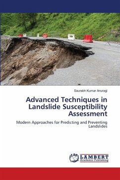
This book provides a comprehensive review of landslide susceptibility assessment, a crucial process for disaster preparedness and land-use planning. It distinguishes between landslide susceptibility (the spatial likelihood of occurrence), hazard (which adds a temporal dimension and intensity), and risk (the quantification of potential losses to people and property). The book details how the field has evolved from simple heuristic mapping to advanced data-driven models, incorporating GIS, remote sensing, and machine learning techniques. It discusses both natural factors (geology, geomorphology, hydrology, and seismic activity) and human-induced factors (like deforestation and improper construction) that contribute to landslides. Case studies, such as the Vaiont Dam disaster, highlight how human error can amplify a natural hazard into a catastrophe. The book emphasizes the need for an integrated, multi-disciplinary approach to build resilient communities.
Bitte wählen Sie Ihr Anliegen aus.
Rechnungen
Retourenschein anfordern
Bestellstatus
Storno

