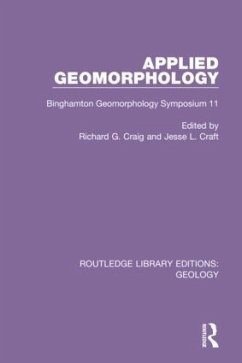
Applied Geomorphology
Binghamton Geomorphology Symposium 11
Herausgeber: Craig, Richard G.; Craft, Jesse L.
Applied Geomorphology
Binghamton Geomorphology Symposium 11
Herausgeber: Craig, Richard G.; Craft, Jesse L.
- Broschiertes Buch
- Merkliste
- Auf die Merkliste
- Bewerten Bewerten
- Teilen
- Produkt teilen
- Produkterinnerung
- Produkterinnerung
This book, first published in 1982, forms the proceedings volume of the 11th Binghamton Geomorphology Symposium. Chapters cover various coastline phenomena, glacial and periglacial processes, carbonate terrains, and specific applications of geomorphic knowledge and techniques.
Andere Kunden interessierten sich auch für
![Applied History; Volume 1 Applied History; Volume 1]() Applied History; Volume 141,99 €
Applied History; Volume 141,99 €![Applied Christianity; Moral Aspects of Social Questions Applied Christianity; Moral Aspects of Social Questions]() Washington GladdenApplied Christianity; Moral Aspects of Social Questions32,99 €
Washington GladdenApplied Christianity; Moral Aspects of Social Questions32,99 €![Eighth International Congress of Applied Chemistry: Washington and New York, September 4 to 13, 1912 ... --; 28 Eighth International Congress of Applied Chemistry: Washington and New York, September 4 to 13, 1912 ... --; 28]() Eighth International Congress of Applied Chemistry: Washington and New York, September 4 to 13, 1912 ... --; 2837,99 €
Eighth International Congress of Applied Chemistry: Washington and New York, September 4 to 13, 1912 ... --; 2837,99 €![Applied History; Volume 2 Applied History; Volume 2]() Applied History; Volume 241,99 €
Applied History; Volume 241,99 €![The Teutonic Name-System Applied to the Family Names of France, England, & Germany The Teutonic Name-System Applied to the Family Names of France, England, & Germany]() Robert FergusonThe Teutonic Name-System Applied to the Family Names of France, England, & Germany39,99 €
Robert FergusonThe Teutonic Name-System Applied to the Family Names of France, England, & Germany39,99 €![Fundamental legal conceptions as applied in judicial reasoning Fundamental legal conceptions as applied in judicial reasoning]() Wesley Newcomb HohfeldFundamental legal conceptions as applied in judicial reasoning17,99 €
Wesley Newcomb HohfeldFundamental legal conceptions as applied in judicial reasoning17,99 €![Rocks and Rifles Rocks and Rifles]() Scott HippensteelRocks and Rifles83,99 €
Scott HippensteelRocks and Rifles83,99 €-
-
-
This book, first published in 1982, forms the proceedings volume of the 11th Binghamton Geomorphology Symposium. Chapters cover various coastline phenomena, glacial and periglacial processes, carbonate terrains, and specific applications of geomorphic knowledge and techniques.
Produktdetails
- Produktdetails
- Verlag: Routledge
- Seitenzahl: 266
- Erscheinungstermin: 15. September 2021
- Englisch
- Abmessung: 234mm x 156mm x 14mm
- Gewicht: 409g
- ISBN-13: 9780367461898
- ISBN-10: 0367461897
- Artikelnr.: 69890280
- Herstellerkennzeichnung
- Libri GmbH
- Europaallee 1
- 36244 Bad Hersfeld
- gpsr@libri.de
Richard G. Craig and Jesse L. Craft
1. Geomorphic Process Data Needs for Environment Management A.G. Everett
2. The Role of Geomorphology in the Identification and Evaluation of
Natural Hazards John J. Clague 3. Landforms for Planning Use in Part of
Pierce County, Washington Allen J. Fiksdal 4. Geomorphology as an Aid to
Hazardous Waste Facility Siting, Northeast United States Allen W. Hatheway
and Zenas F. Bliss 5. Geomorphic Manifestations of Salt Dome Stability Z.
Berger and J. Aghassy 6. Slope Movements Related to Expansive Soils on the
Blackland Prairie, North Central Texas James T. Kirkland and James C.
Armstrong 7. Prediction of Engineering Properties and Construction
Conditions from Geomorphic Mapping in Regional Siting Studies Gary E.
Christenson, James R. Miller and Denise D. Pieratti 8. Criteria for
Constructing Optimal Digital Terrain Models Richard G. Craig 9. Geomorphic
Processes and Land Use Planning, South Texas Barrier Islands Christopher C.
Mathewson and William F. Cole 10. Man-Made Structures and Geomorphic
Changes Since 1876 Along the Ohio Shore of Lake Erie C.H. Carter, D.J.
Benson and D.E. Guy, Jr. 11. Erosion Hazards Along the Mid-Atlantic Coast
Robert Dolan, Bruce Hayden, Suzette K. May and Paul May 12. Geomorphology
and Land Subsidence in Bangkok, Thailand Jon L. Rau and Prinya Nutalaya
13. Land Use in Carbonite Terrain: Problems and Case Study Solutions
Katherine A. Sheedy, Walter M. Leis, Abraham Thomas and William F. Beers
14. ERODE - A Computer Model of Drainage Basin Development Under Changing
Baselevel Conditions N. Luanne Vanderpool 15. Morphologic and Morphometric
Response to Channelization: The Case History of Big Pine Creek Ditch,
Benton County, Indiana Robert S. Barnard and Wilton N. Melhorn 16.
Evaluating Aquatic Habitat Using Stream Network Structure and Streamflow
Prediction John B. Stall and Edwin E. Herricks


