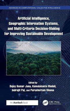
Artificial Intelligence, Geographic Information Systems, and Multi-Criteria Decision-Making for Improving Sustainable Development
Herausgeber: Jana, Sujoy Kumar; Pal, Indrajit; Muduli, Kamalakanta
Artificial Intelligence, Geographic Information Systems, and Multi-Criteria Decision-Making for Improving Sustainable Development
Herausgeber: Jana, Sujoy Kumar; Pal, Indrajit; Muduli, Kamalakanta
- Gebundenes Buch
- Merkliste
- Auf die Merkliste
- Bewerten Bewerten
- Teilen
- Produkt teilen
- Produkterinnerung
- Produkterinnerung
The book looks at how artificial intelligence, geographic information systems, and multi-criteria decision making could be used to come up with strategies for building resilience and achieving sustainable development in the Asia-Pacific region.
Andere Kunden interessierten sich auch für
![Multi-Criteria Decision Making Theory and Applications in Sustainable Healthcare Multi-Criteria Decision Making Theory and Applications in Sustainable Healthcare]() Mohamed Abdel-BassetMulti-Criteria Decision Making Theory and Applications in Sustainable Healthcare150,99 €
Mohamed Abdel-BassetMulti-Criteria Decision Making Theory and Applications in Sustainable Healthcare150,99 €![Multiple-Criteria Decision Making Multiple-Criteria Decision Making]() Multiple-Criteria Decision Making89,99 €
Multiple-Criteria Decision Making89,99 €![Big Data Analytics Using Multiple Criteria Decision-Making Models Big Data Analytics Using Multiple Criteria Decision-Making Models]() Big Data Analytics Using Multiple Criteria Decision-Making Models159,99 €
Big Data Analytics Using Multiple Criteria Decision-Making Models159,99 €![Decision Support, Analytics, and Business Intelligence, Second Edition Decision Support, Analytics, and Business Intelligence, Second Edition]() Daniel J. PowerDecision Support, Analytics, and Business Intelligence, Second Edition13,99 €
Daniel J. PowerDecision Support, Analytics, and Business Intelligence, Second Edition13,99 €![Enhancing Communication and Decision-Making With AI Enhancing Communication and Decision-Making With AI]() Enhancing Communication and Decision-Making With AI242,99 €
Enhancing Communication and Decision-Making With AI242,99 €![Satisficing Games and Decision Making Satisficing Games and Decision Making]() Wynn C. StirlingSatisficing Games and Decision Making104,99 €
Wynn C. StirlingSatisficing Games and Decision Making104,99 €![Satisficing Games and Decision Making Satisficing Games and Decision Making]() Wynn C. StirlingSatisficing Games and Decision Making67,99 €
Wynn C. StirlingSatisficing Games and Decision Making67,99 €-
-
-
The book looks at how artificial intelligence, geographic information systems, and multi-criteria decision making could be used to come up with strategies for building resilience and achieving sustainable development in the Asia-Pacific region.
Produktdetails
- Produktdetails
- Verlag: Auerbach Publications
- Seitenzahl: 228
- Erscheinungstermin: 12. August 2025
- Englisch
- Abmessung: 240mm x 161mm x 17mm
- Gewicht: 511g
- ISBN-13: 9781032669977
- ISBN-10: 1032669977
- Artikelnr.: 73496261
- Herstellerkennzeichnung
- Libri GmbH
- Europaallee 1
- 36244 Bad Hersfeld
- gpsr@libri.de
Dr. Sujoy Kumar Jana is an Associate Professor of the GIS section, Department of Surveying & Land Studies at the Papua New Guinea University of Technology. Dr. Kamalakanta Muduli is as an Associate Professor in the Department of Mechanical Engineering, Papua New Guinea University of Technology. Dr. Indrajit Pal is an Associate Professor and the Chair of the Disaster Preparedness, Mitigation and Management and Deputy Director of the Research Center "South- and Southeast Asia Multi-disciplinary Applied Research Network on Transforming Societies of Global South (SMARTS)" at the Asian Institute of Technology, Thailand. Dr. Purushottam Meena is a member of the Supply Chain Management Faculty in the School of Business at the College of Charleston, South Carolina, USA.
1. Pathways for Sustainable Development and Multi-Criteria Decision-Making
Using AI and GIS 2. Sustainable Development through Geospatial
Multi-Criteria Decision-Making (MCDM): A Comprehensive Analysis 3.
Enhancing Sustainable Development Goals (SDG) through Geographic
Information Systems and Mult-Criteria Decision-Making: A Case Study of Hong
Kong 4. Urban Disaster Planning and Flood Hazard Zonation from a Geomatic,
GIS and Urban Planning Perspective: A Case Study of Sigatoka Town, Fiji
Islands 5. Learning Lessons from the Scenario Changes of Air Quality with
Reference to the Pandemic in Delhi NCR: A MCDM Approach for Fighting Air
Pollution 6. Monitoring the Forest Cover of the Chiang Mai Area in
Thailand: A Geospatial Approach 7. Optimization of Solid Waste Collection
and Distribution Using GIS Technology 8. Spatial Association between
Population Characteristics and Visceral Leishmaniasis Incidence in
Muzaffarpur District, Bihar (India) 9. Hydropower Site Optimization for
Sustainable Energy Supply: A Case Study 10. Role of Smart Sensor in
Internet of Things for Structural Health Monitoring of Composite Structures
11. State of Geospatial Data for Environmental Governance in Bangladesh 12.
Establishing a New Sustainable Rice Cultivar in the Cyclone-Affected Zones
of the Sundarban Mangrove Ecosystem


