Schade – dieser Artikel ist leider ausverkauft. Sobald wir wissen, ob und wann der Artikel wieder verfügbar ist, informieren wir Sie an dieser Stelle.
- Broschiertes Buch
- Merkliste
- Auf die Merkliste
- Bewerten Bewerten
- Teilen
- Produkt teilen
- Produkterinnerung
- Produkterinnerung
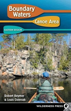
This guide describes 28 entry points in the eastern part of the BWCA Wilderness-those accessible near Grand Marais from the Sawbill Trail and the Gunflint Trail.
Andere Kunden interessierten sich auch für
This guide describes 28 entry points in the eastern part of the BWCA Wilderness-those accessible near Grand Marais from the Sawbill Trail and the Gunflint Trail.
Produktdetails
- Produktdetails
- Verlag: Wilderness Press
- 5th edition
- Seitenzahl: 280
- Erscheinungstermin: 9. Juli 2009
- Englisch
- Abmessung: 213mm x 140mm x 18mm
- Gewicht: 341g
- ISBN-13: 9780899974613
- ISBN-10: 0899974619
- Artikelnr.: 23861766
- Herstellerkennzeichnung
- Libri GmbH
- Europaallee 1
- 36244 Bad Hersfeld
- gpsr@libri.de
Robert Beymer has been a frequent visitor to the Boundary Waters Cano Area Wilderness for the past 40 years, and was a canoe trip guide for seven summers at a private camp near Ely. He and his wife, Cheryl, have lived on the edge of the wilderness since 1984. Their home serves as a convenient starting point for day trips by canoe, as well as on foot, snowshoes, and cross-country skis. In addition to his two volume guide to the Boundary Waters Canoe Area, Bob has written three other books about the Quetico-Superior region of northeastern Minnesota and Ontario. His articles have appeared in numerous outdoor magazines, including Boundary Waters Journal, Silent Sports Magazine, Camping Journal, and Minneapolis-St. Paul Magazine. When the muse screaming in his ear was too loud to ignore, Louis Dzierzak walked away from a successful advertising career to become a full-time freelance writer. He's written about issues and trends in outdoor recreation for over a decade. Lou firmly believes that paddling in the Boundary Waters Canoe Area is the best way to recover from constant publishing deadlines.
Acknowledgments
locator Map of Boundary Water Canoe Area: Eastern Region
Prefaces
Chapter 1: introduction to the BWCA Wilderness
Chapter 2: How to Plan a Wilderness Canoe trip
Chapter 3: Entry from the Sawbill Trail
* Entry Point 36-Hog Creek
* Entry Point 37-Kawishiwi Lake
* Entry Point 38-Sawbill Lake
* Entry Point 39-Baker Lake
* Entry Point 40-Homer Lake
* Entry Point 41-Brule Lake
Chapter 4: Entry from the Gunflint Trail-West
* Entry Point 43-Bower Trout Lake
* Entry Point 44-Ram Lake
* Entry Point 45-Morgan Lake
* Entry Point 47-Lizz Lake & Swamp Lake
* Entry Point 48-Meeds Lake
* Entry Point 49-Skipper Lake & Portage Lake
* Entry Point 50-Cross Bay Lake
* Entry Point 51-Missing Link Lake
* Entry Point 52-Brant Lake
* Entry Point 54-Seagull Lake
* Entry Point 55-Saganaga Lake
Chapter 5: Entry from the Gunflint Trail-East and Arrowhead trail
* Entry Point 80-Larch Creek
* Entry Point 57-Magnetic Lake
* Entry Point 58-South Lake
* Entry Point 60-Duncan Lake
* Entry Point 61-Daniels Lake
* Entry Point 62-Clearwater Lake
* Entry Point 64-East Bearskin Lake
* Entry Point 66-Crocodile River
* Entry Point 68-Pine Lake
* Entry Point 69-John Lake
* Entry Point 70-North Fowl Lake
Appendix i: Routes Categorized by Difficulty and Duration
Appendix ii: Commercial Canoe trip outfitters
Appendix iii: lake index for fishing
Appendix iV: BWCAW Hiking trails in the Eastern Region
Appendix V: More Resources
Photo Credits
Index


