24,99 €
inkl. MwSt.
Versandkostenfrei*
Versandfertig in 6-10 Tagen
payback
12 °P sammeln
  • Broschiertes Buch

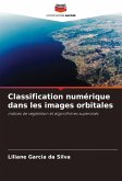
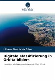
This book is a chapter of the author's PhD thesis in Environmental and Forestry Sciences at the Federal Rural University of Rio de Janeiro (UFRRJ), entitled "Digital mapping of land use and land cover in a biodiversity hotspot (Atlantic Forest) in the Capivari River basin", which she dedicates to readers interested in Digital Mapping in Remote Sensing using vegetation indices and supervised algorithms. Remote sensing data provides information for modeling, analyzing changes, making decisions, planning phenomena and conserving biodiversity associated with land use and occupation in various biomes in Brazil.…mehr

Produktbeschreibung
This book is a chapter of the author's PhD thesis in Environmental and Forestry Sciences at the Federal Rural University of Rio de Janeiro (UFRRJ), entitled "Digital mapping of land use and land cover in a biodiversity hotspot (Atlantic Forest) in the Capivari River basin", which she dedicates to readers interested in Digital Mapping in Remote Sensing using vegetation indices and supervised algorithms. Remote sensing data provides information for modeling, analyzing changes, making decisions, planning phenomena and conserving biodiversity associated with land use and occupation in various biomes in Brazil.
Autorenporträt
Elle est ingénieur en environnement et en sécurité du travail, titulaire d'un master en agroénergie et candidate au doctorat en sciences de l'environnement et de la forêt. Elle enseigne l'écologie, la pollution environnementale et le traitement des eaux usées à l'Institut fédéral d'éducation de Tocantins (IFTO) et est chercheuse en cartographie de la dynamique des paysages par télédétection et géotraitement.