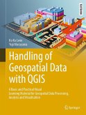
GIS have a positive impact on land use planning and natural resource management. Cameroon, having understood this, established in July 2016 a document entitled "Exploitation Inventory Guidelines", for better management of its forest heritage. This book provides guidance on the techniques to use for geolocating trees and presenting inventory results. It is in line with this work that we considered it appropriate to write this practical manual, which provides detailed information on the in-depth handling of GIS tools on the cartographic management of forest inventories. Its role is to guide users step by step on how to get started with QGIS, from installation to the design of operational inventory maps at regulatory scales, while respecting the geographical positioning of all tree bases as well as other land uses listed during the inventory work. It is divided into six chapters.
Bitte wählen Sie Ihr Anliegen aus.
Rechnungen
Retourenschein anfordern
Bestellstatus
Storno


