Elizabeth Wenk
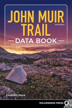
John Muir Trail Data Book
Elizabeth Wenk
John Muir Trail Data Book
- Broschiertes Buch
- Merkliste
- Auf die Merkliste
- Bewerten Bewerten
- Teilen
- Produkt teilen
- Produkterinnerung
- Produkterinnerung
Perfect for the pack-weight-conscious hiker, this condensed version of John Muir Trail includes only the data sections of its parent book.
Andere Kunden interessierten sich auch für
![John Muir Trail John Muir Trail]() Elizabeth WenkJohn Muir Trail26,99 €
Elizabeth WenkJohn Muir Trail26,99 €![Backpacking Oregon Backpacking Oregon]() Becky OhlsenBackpacking Oregon17,99 €
Becky OhlsenBackpacking Oregon17,99 €![Top Trails: Northern California's Redwood Coast Top Trails: Northern California's Redwood Coast]() Mike WhiteTop Trails: Northern California's Redwood Coast17,99 €
Mike WhiteTop Trails: Northern California's Redwood Coast17,99 €![Moon Washington Hiking Moon Washington Hiking]() Craig HillMoon Washington Hiking15,99 €
Craig HillMoon Washington Hiking15,99 €![Pacific Crest Trail Data Book Pacific Crest Trail Data Book]() Benedict GoPacific Crest Trail Data Book17,99 €
Benedict GoPacific Crest Trail Data Book17,99 €![Moon Northern California Hiking Moon Northern California Hiking]() Ann BrownMoon Northern California Hiking21,99 €
Ann BrownMoon Northern California Hiking21,99 €![The Enduring Wild The Enduring Wild]() Josh JacksonThe Enduring Wild28,99 €
Josh JacksonThe Enduring Wild28,99 €-
-
-
Perfect for the pack-weight-conscious hiker, this condensed version of John Muir Trail includes only the data sections of its parent book.
Produktdetails
- Produktdetails
- Verlag: Wilderness Press
- 2 Revised edition
- Seitenzahl: 112
- Erscheinungstermin: 30. August 2022
- Englisch
- Abmessung: 226mm x 153mm x 10mm
- Gewicht: 164g
- ISBN-13: 9781643590936
- ISBN-10: 1643590936
- Artikelnr.: 63240953
- Herstellerkennzeichnung
- Libri GmbH
- Europaallee 1
- 36244 Bad Hersfeld
- gpsr@libri.de
From childhood, Elizabeth “Lizzy” Wenk has hiked and climbed in the Sierra Nevada with her family. Since she started college, she has found excuses to spend every summer in the Sierra, with its beguiling landscape, abundant flowers, and near-perfect weather. One interest lies in biological research, and she worked first as a research assistant for others and then completed her own PhD thesis research on the effects of rock type on alpine plant distribution and physiology. However, much of the time, she hikes simply for leisure. Obsessively wanting to explore every bit of the Sierra, she has hiked thousands of on- and off-trail miles and climbed more than 600 peaks in the mountain range. Many of her wanderings are now directed to gather data for several Wilderness Press titles and to introduce her two young daughters to the wonders of the mountains. For them as well, the Sierra, and especially Yosemite, has become a favorite location. Although she will forever consider Bishop, California, home, Lizzy is currently living in Sydney, Australia, with her husband, Douglas, and daughters, Eleanor and Sophia. There she is working as a research fellow at Macquarie University and enjoying Australia’s exquisite eucalyptus forests, vegetated slot canyons, and wonderful birdlife—except during the Northern Hemisphere summer, which she continues to spend exploring the Sierra.
Introduction
Planning Your Hike
Topographic Maps
Yosemite Valley to Whitney Portal
1. Happy Isles to Tuolumne-Mariposa County Line
2. Tuolumne-Mariposa County Line to Donohue Pass
3. Donohue Pass to Island Pass
4. Island Pass to Madera-Fresno County Line
5. Madera-Fresno County Line to Silver Pass
6. Silver Pass to Selden Pass
7. Selden Pass to Muir Pass
8. Muir Pass to Mather Pass
9. Mather Pass to Pinchot Pass
10. Pinchot Pass to Glen Pass
11. Glen Pass to Forester Pass
12. Forester Pass to Trail Crest
13. Trail Crest to Whitney Portal
Panoramas
Campsites
Ranger Stations and Emergency Numbers
Food-Storage Boxes (Bear Boxes)
JMT Lateral Trails
About the Author

