34,99 €
inkl. MwSt.
Versandkostenfrei*
Versandfertig in 6-10 Tagen
payback
17 °P sammeln
  • Broschiertes Buch

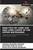
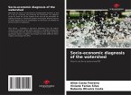
This work deals with the relationships that exist in land use and occupation, based on social and spatial changes that occur over time in a watershed in the northeastern region of Pará. Geotechnology based on satellite image classification was used as a tool for analyzing the processes that surround this type of ecosystem, to help understand the patterns of transformations in vegetation cover and the impacts generated by different types of use in permanent preservation areas, which in turn are endowed with special management conditions, legally recognized by the Brazilian Forest Code. The…mehr

Produktbeschreibung
This work deals with the relationships that exist in land use and occupation, based on social and spatial changes that occur over time in a watershed in the northeastern region of Pará. Geotechnology based on satellite image classification was used as a tool for analyzing the processes that surround this type of ecosystem, to help understand the patterns of transformations in vegetation cover and the impacts generated by different types of use in permanent preservation areas, which in turn are endowed with special management conditions, legally recognized by the Brazilian Forest Code. The research is the result of a Master's Degree in Forestry Sciences, in the area of Forest Management, presented to the Federal Rural University of Amazonia.
Autorenporträt
Je suis ingénieur forestier diplômé de l'Université rurale fédérale d'Amazonie, où j'ai également obtenu un diplôme de troisième cycle en sciences forestières, avec une spécialisation en surveillance de l'environnement. Je suis également titulaire d'un diplôme technique en géomatique de l'IFPA et d'une spécialisation en gestion urbaine et en durabilité.