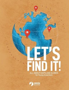
This is a book about maps and globes, how they work, and how to use them to find places on the earth, both locally and globally. The amply-illustrated text introduces students to map scales, symbols, directions and grids and provides activities for building familiarity by making and using maps to find their way. It explains how to use features like hemisphere, latitude, longitude and coordinates to find places on a globe and provides activities for doing so.
Bitte wählen Sie Ihr Anliegen aus.
Rechnungen
Retourenschein anfordern
Bestellstatus
Storno


![A System of Modern Geography, Physical, Political, and Descriptive [microform]: Accompanied by a New Atlas of Forty-four Copperplate Maps and Illustra A System of Modern Geography, Physical, Political, and Descriptive [microform]: Accompanied by a New Atlas of Forty-four Copperplate Maps and Illustra](https://bilder.buecher.de/produkte/65/65635/65635874m.jpg)
![The Pocket Atlas of the World [cartographic Material]: a Comprehensive and Popular Series of Maps Illustrating Physical and Political Geography The Pocket Atlas of the World [cartographic Material]: a Comprehensive and Popular Series of Maps Illustrating Physical and Political Geography](https://bilder.buecher.de/produkte/65/65545/65545791m.jpg)