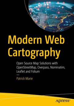
Modern Web Cartography is your ultimate guide to practical web maps using open source tools, with a particular focus on OpenStreetMap (OSM) and its rich ecosystem. In an era where maps are embedded in virtually every digital service from navigation apps to data dashboards, understanding how to build and customize them is more valuable than ever. While proprietary solutions like Google Maps dominate the market, open source alternatives offer greater flexibility, transparency, and control over data.
OSM is at the forefront of this movement, supported by a growing community and a variety of powerful tools such as Overpass (for data extraction), Nominatim (for geocoding), Leaflet (for browser-based map rendering), and Folium (for map creation in Python).
This book is structured to build knowledge progressively. Early chapters introduce OSM and its data model, then move on to APIs and tools for querying and retrieving map data. Readers learn to create maps both in the browser (using JavaScript and Leaflet) and on the server (using Python and Folium). Advanced sections demonstrate how to integrate multiple tools combining Overpass data queries, Nominatim geocoding, and OSRM routing into cohesive web applications. Code examples and hands-on exercises anchor theoretical concepts in real-world applications.
As more organizations and individual developers look for alternatives to commercial platforms, the skills taught in this book are relevant, and empowering leaving readers with the confidence and ability to build robust, customized mapping applications without vendor lock-in and at zero cost.
You Will:
Learn to develop interactive web maps
Explore how to integrate geospatial services into web applications
Build complete open source mapping workflows
Gain the ability to prototype, test, and deploy custom cartographic applications
This Book is For:
Developers looking to add mapping features to web applications.
Data analysts and GIS enthusiasts interested in open source spatial data.
Educators and students learning about geospatial technology through practical projects.
Tech-savvy hobbyists who want to experiment with mapping tools outside of commercial platforms

