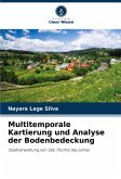
Land cover mapping using remote sensing data and digital image processing techniques has spread globally because it allows for a spatial and dynamic analysis of land cover typologies. Mining is one of the environmental transforming activities that causes the most adverse impacts, even if they are concentrated, due to the activity's locational rigidity. It is an activity that requires environmental control throughout the process in order to reduce negative impacts and guarantee a balanced environment. In this context, the aim of this study was to carry out a multi-temporal analysis of land cover in the municipality of São Thomé das Letras, in the state of Minas Gerais, quantifying and spatializing the changes over the period from 1984 to 2011. The aim was to visualize the behaviour of mining activity from its inception to the present day and, consequently, to observe the dynamism of the changes that have occurred in the land cover of the other established classes.
Bitte wählen Sie Ihr Anliegen aus.
Rechnungen
Retourenschein anfordern
Bestellstatus
Storno


