N Baghdadi
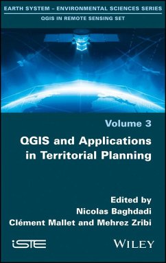
Qgis and Applications in Territorial Planning
Herausgeber: Baghdadi, Nicolas; Zribi, Mehrez; Mallet, Clément
Schade – dieser Artikel ist leider ausverkauft. Sobald wir wissen, ob und wann der Artikel wieder verfügbar ist, informieren wir Sie an dieser Stelle.
N Baghdadi
Qgis and Applications in Territorial Planning
Herausgeber: Baghdadi, Nicolas; Zribi, Mehrez; Mallet, Clément
- Gebundenes Buch
- Merkliste
- Auf die Merkliste
- Bewerten Bewerten
- Teilen
- Produkt teilen
- Produkterinnerung
- Produkterinnerung
These four volumes present innovative thematic applications implemented using the open source software QGIS. These are applications that use remote sensing over continental surfaces. The volumes detail applications of remote sensing over continental surfaces, with a first one discussing applications for agriculture. A second one presents applications for forest, a third presents applications for the continental hydrology, and finally the last volume details applications for environment and risk issues.
Andere Kunden interessierten sich auch für
![Territorial Water Cooperation in the Central Plateau of Iran Territorial Water Cooperation in the Central Plateau of Iran]() Majid Labbaf KhaneikiTerritorial Water Cooperation in the Central Plateau of Iran38,99 €
Majid Labbaf KhaneikiTerritorial Water Cooperation in the Central Plateau of Iran38,99 €![Sustainable Urban Planning Sustainable Urban Planning]() Robert RiddellSustainable Urban Planning54,99 €
Robert RiddellSustainable Urban Planning54,99 €![Introduction to Mathematical Methods for Environmental Engineers and Scientists Introduction to Mathematical Methods for Environmental Engineers and Scientists]() Charles ProchaskaIntroduction to Mathematical Methods for Environmental Engineers and Scientists182,99 €
Charles ProchaskaIntroduction to Mathematical Methods for Environmental Engineers and Scientists182,99 €![Visualizing Environmental Science Visualizing Environmental Science]() David M HassenzahlVisualizing Environmental Science143,99 €
David M HassenzahlVisualizing Environmental Science143,99 €![The Mediterranean Sea in the Era of Global Change 1 The Mediterranean Sea in the Era of Global Change 1]() The Mediterranean Sea in the Era of Global Change 1158,99 €
The Mediterranean Sea in the Era of Global Change 1158,99 €![Stock Assessment in Inland Fisheries Stock Assessment in Inland Fisheries]() Stock Assessment in Inland Fisheries229,99 €
Stock Assessment in Inland Fisheries229,99 €![Environmental Pest Management Environmental Pest Management]() Environmental Pest Management149,99 €
Environmental Pest Management149,99 €-
-
-
These four volumes present innovative thematic applications implemented using the open source software QGIS. These are applications that use remote sensing over continental surfaces. The volumes detail applications of remote sensing over continental surfaces, with a first one discussing applications for agriculture. A second one presents applications for forest, a third presents applications for the continental hydrology, and finally the last volume details applications for environment and risk issues.
Produktdetails
- Produktdetails
- Verlag: Wiley
- Seitenzahl: 288
- Erscheinungstermin: 20. Februar 2018
- Englisch
- Abmessung: 234mm x 163mm x 20mm
- Gewicht: 544g
- ISBN-13: 9781786301895
- ISBN-10: 178630189X
- Artikelnr.: 50991809
- Herstellerkennzeichnung
- Libri GmbH
- Europaallee 1
- 36244 Bad Hersfeld
- gpsr@libri.de
- Verlag: Wiley
- Seitenzahl: 288
- Erscheinungstermin: 20. Februar 2018
- Englisch
- Abmessung: 234mm x 163mm x 20mm
- Gewicht: 544g
- ISBN-13: 9781786301895
- ISBN-10: 178630189X
- Artikelnr.: 50991809
- Herstellerkennzeichnung
- Libri GmbH
- Europaallee 1
- 36244 Bad Hersfeld
- gpsr@libri.de
Nicolas Baghdadi is Research Director at the National Research Institute of Science and Technology for the Environment and Agriculture (IRSTEA). He is currently Scientific Director of the Theia Land Data Centre (France). Clément Mallet is a senior researcher at the National Institute of Geographic and Forest Information (IGN). He is a member of the LaSTIG laboratory, a joint lab between IGN and the University of Paris-Est, France. Mehrez Zribi is Research Director at the National Center for Scientific Research (CNRS). He is currently working at the Center for the Study of the Biosphere from Space (CESBIO) in Toulouse (France) where he is also responsible for the "Observation Systems" team.
Introduction ix
Chapter 1. Design and Implementation of Automated Atlas 1
Boris MERICSKAY
1.1. From map to atlas 1
1.2. Automation of maps and indicators 2
1.2.1. Step 1: atlas template designing 4
1.2.2. Step 2: data preparation and indicators creation 4
1.2.3. Step 3: atlas implementation in QGIS project 8
1.2.4. Step 4: atlas implementation in print composer 13
1.2.5. Step 5: atlas publication 16
1.3. Implementation of the application 17
1.3.1. Software and data 17
1.3.2. Step 2: data preparation and indicators creation 19
1.3.3. Step 3: atlas implementation in QGIS project 25
1.3.4. Step 4: atlas implementation in print composer 29
1.3.5. Step 5: atlas publication 37
Chapter 2. Estimation of Land Use Efficiency from the Global Human
Settlement Layer (GHSL) 39
Christina CORBANE, Panagiotis POLITIS, Martino PESARESI, Thomas KEMPER and
Alice SIRAGUSA
2.1. Context 39
2.2. The Land Use Efficiency (LUE) 40
2.3. Installation of the LUE indicator calculation tool 41
2.4. Method to calculate the LUE indicator 42
2.4.1. Preparation of the input layer 44
2.4.2. Delimitation of the area of interest and clip of input data 45
2.4.3. Calculation of the LUE indicator 47
2.4.4. Visualization and analysis of the results 48
2.4.5. One possible interpretation 50
2.5. Limits of the method 51
2.6. Bibliography 52
Chapter 3. Characterizing Urban Morphology for Urban Climate Simulation
Based on a GIS Approach 53
Justin EMERY, Julita DUDEK, Ludovic GRANJON, Benjamin POHL, Yves RICHARD,
Thomas THEVENIN and Nadège MARTINY
3.1. The city-climate relationship through urban climate modeling 53
3.2. Representation of the urban space 56
3.2.1. Step 1: integrate urban morphology in a DTM 59
3.2.2. Step 2: generate land use in a urban space 62
3.2.3. Step 3: calculate the anthropization index 71
3.2.4. Discussions and perspectives: contribution of remote sensing to
vegetation mapping 73
3.3. Practical case study of the processing chain 76
3.3.1. Software and database 76
3.3.2. Step 1: integrate the building heights into a DTM 77
3.3.3. Step 2: geographic data generation about natural and artificial
areas 80
3.3.4. Step 3: calculation of the anthropization index 88
3.4. Bibliography 90
Chapter 4. Airborne Optical Remote Sensing Potential for Pool Mapping in an
Urban Environment 93
Josselin AVAL and Thierry ERUDEL
4.1. Context 93
4.2. Method 94
4.2.1. Data acquisition and preprocessing 96
4.2.2. Reference map definition 99
4.2.3. Feature extraction 101
4.2.4. Classification 103
4.2.5. Building a prediction map 107
4.2.6. Performance assessment 107
4.2.7. Limits of the proposed method 108
4.3. Implementation of the application 109
4.3.1. Software and data 109
4.3.2. Step 1: creation of a georeferenced image 110
4.3.3. Step 2: building a reference map 114
4.3.4. Step 3: classification and prediction map 116
4.4. Bibliography 122
Chapter 5. Automation of Workflows for the Installation of a Wind Farm 125
Boris MERICSKAY
5.1. Automation of workflows 125
5.2. Automation of workflows for the installation of a wind farm in
Brittany 126
5.2.1. Step 1: download data with WFSs 127
5.2.2. Step 2: preparation of the population grid dataset 130
5.2.3. Step 3: identification of inhabited areas 131
5.2.4. Step 4: consideration of protected areas 134
5.2.5. Step 5: consideration of regional wind policy and wind energy
criteria 137
5.2.6. Step 6: proximity to power lines 139
5.3. Implementation of the application 142
5.3.1. Software and data 142
5.3.2. Step 1: downloading datasets 145
5.3.3. Step 2: preparation of population grid dataset 149
5.3.4. Step 3: identification of inhabited areas 154
5.3.5. Step 4: consideration of protected areas 157
5.3.6. Step 5: consideration of the regional wind policy and wind energy
criteria 162
5.3.7. Step 6: consideration of proximity to power lines 165
Chapter 6. Ecosystemic Services Assessment: Application to Forests for the
Preservation of Water Resources in Tropical Islands 169
Rémi ANDREOLI and Brice VAN HAAREN
6.1. Definition and context 169
6.2. Method 170
6.2.1. Water catchment perimeter database (PPE) preparation 172
6.2.2. Soil stabilization criterion: the erosion hazard parameter 174
6.2.3. Water regulation criterion and ecosystem degradation: the dominant
vegetation parameter 177
6.2.4. Resilience criterion: forest fragmentation parameter 181
6.2.5. Assessment of the forest function in the PPE 186
6.2.6. Limits 188
6.3. Forest function assessment implementation 188
6.3.1. Software and data 188
6.3.2. Step 1: PPE polygons creation 190
6.3.3. Step 2: erosion hazard parameter determination 199
6.3.4. Step 3: dominant vegetation type parameter determination 205
6.3.5. Step 4: forest fragmentation parameter 216
6.3.6. Step 5: forest function assessment for water protection 231
6.4. Bibliography 234
Chapter 7. Assessing the Influence of Landscape on Biodiversity Using the
QGIS Plugin LecoS 239
Sylvie LADET, David SHEEREN, Pierre-Alexis HERRAULT and Mathieu FAUVEL
7.1. Introduction 239
7.2. Principle of the approach 239
7.3. Materials and methods 242
7.3.1. Step 1: land cover map 242
7.3.2. Step 2: definition of the relevant landscape descriptors 244
7.3.3. Step 3: statistical modeling 246
7.4. Application of the processing chain: effect of landscape on forest
bird diversity 247
7.4.1. "Birds" data and the variable to be explained 247
7.4.2. "Landscape" data and the explanatory variables 248
7.4.3. Implementation in QGIS environment 250
7.5. Acknowledgments 262
7.6. Bibliography 262
List of Authors 265
Index 269
Scientific Committee 271

