- Broschiertes Buch
- Merkliste
- Auf die Merkliste
- Bewerten Bewerten
- Teilen
- Produkt teilen
- Produkterinnerung
- Produkterinnerung
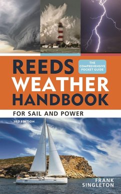
An essential pocket-sized primer that equips sailors and outdoors enthusiasts with the knowledge to read and predict the weather.
Andere Kunden interessierten sich auch für
![Reeds Eastern Almanac Reeds Eastern Almanac]() ReedsReeds Eastern Almanac50,99 €
ReedsReeds Eastern Almanac50,99 €![Reeds Vol 11: Engineering Drawing Reeds Vol 11: Engineering Drawing]() H G BeckReeds Vol 11: Engineering Drawing50,99 €
H G BeckReeds Vol 11: Engineering Drawing50,99 €![Reeds Vol 9: Steam Engineering Knowledge for Marine Engineers Reeds Vol 9: Steam Engineering Knowledge for Marine Engineers]() Thomas D MortonReeds Vol 9: Steam Engineering Knowledge for Marine Engineers50,99 €
Thomas D MortonReeds Vol 9: Steam Engineering Knowledge for Marine Engineers50,99 €![Rough Weather Seamanship for Sail and Power Rough Weather Seamanship for Sail and Power]() Roger MarshallRough Weather Seamanship for Sail and Power24,99 €
Roger MarshallRough Weather Seamanship for Sail and Power24,99 €![Sailor's Weather Guide Sailor's Weather Guide]() Jeff MarkellSailor's Weather Guide32,99 €
Jeff MarkellSailor's Weather Guide32,99 €![Norwegian Cruising Guide 8th Edition Vol 5 Norwegian Cruising Guide 8th Edition Vol 5]() Phyllis L NickelNorwegian Cruising Guide 8th Edition Vol 530,99 €
Phyllis L NickelNorwegian Cruising Guide 8th Edition Vol 530,99 €![Guía Básica Reeds del tripulante Guía Básica Reeds del tripulante]() Guía Básica Reeds del tripulante18,99 €
Guía Básica Reeds del tripulante18,99 €-
-
-
An essential pocket-sized primer that equips sailors and outdoors enthusiasts with the knowledge to read and predict the weather.
Produktdetails
- Produktdetails
- Verlag: Bloomsbury USA
- 3rd edition
- Seitenzahl: 144
- Erscheinungstermin: 17. März 2026
- Englisch
- Abmessung: 160mm x 100mm x 25mm
- Gewicht: 454g
- ISBN-13: 9781399422734
- ISBN-10: 1399422731
- Artikelnr.: 73935144
- Herstellerkennzeichnung
- Libri GmbH
- Europaallee 1
- 36244 Bad Hersfeld
- gpsr@libri.de
Frank Singleton is a former Senior Forecaster with the Met Office and is an RYA Yachtmaster with over 60,000 miles under his keel. He has cruised widely in European and Mediterranean waters. His weather website for sailors (weather.mailasail.com/Franks-Weather) is known worldwide as an extensive, informed and informative resource for all sea-goers. He has given many lectures to sailors, especially for the Cruising Association and the Royal Yachting Association.
Introduction
Air masses
-Understanding air masses
-Air directly from polar regions
-Air indirectly from polar regions
-Air from the subtropics
-Tropical air
-Air mass with a land track
-Fog
-Sea fog areas
-Other causes of sea fog
-Showers and thunderstorms
-Lightning
-Lightning protection
-Avoiding the risk
-Other dangers of thunderstorms
Fronts and depressions
-Frontal lows and their formation
-What you may see at sea level
-Occluded fronts
-Interpretation of synoptic charts
-Non-frontal lows
Sea and land effects
-How breezes are formed
-The sea breeze front
-What affects the sea breeze?
-Land breezes
-Sea/land breeze cycles
-How strong? How far out to sea? How far inland?
-Cliffs, straits and headlands
Waves and swell
-Understanding sea state
-Wind waves
-Swell
-Water depth and tidal stream
-Reflection and refraction
-Sea state - general advice
-Lagoon, bay and seiche effects
-Tsunamis
Weather forecasting - the background
-Why weather prediction is so difficult
-Before computers
-Numerical weather prediction (NWP)
-Limitations to NWP
-Ensembles and probability forecasts
-Grid spacing
-Small-scale NWP
Using forecasts - and your experience
-Planning
-Weather and whether to go?
-Day sailing and coastal passages
-Passage making
-Examples
-Learning by experience
-Ocean crossings
Sources of weather information
-Types of marine forecast available
-The Global Maritime Distress and Safety System (GMDSS)
-Forecast areas and schedules
-Forecast texts
-Other GMDSS services
-GRIB files and products
-Basic (free) services
-Processed or selected GRIB data
-Fine-scale GRIB data
-On prepayment
-Consultants
-Actual weather reports
Getting forecasts
-Radio or internet?
-Marine VHF and MF
-NAVTEX
-MF/HF/SSB radio
-The internet
-Internet access - coastal and ashore
-Internet access - long range
Observing - learning by experience
-Weather lore and rules of thumb Nowcasting
-Examples of unusual cloud patterns
-Mountain waves
-Bora cloud
-Mammatus cloud
Appendix
-Acronyms and abbreviations
-Meteorological terms
-Terms used in marine weather forecasts
-Beaufort wind scale
-Douglas sea state
-Gale and strong wind warnings
-Wind direction
-Visibility
-Terms used in UK Met Office forecasts
-Gale warning timings
-Movement of pressure systems
-Pressure tendency in station reports
-Sources of information
Index

