183,95 €
183,95 €
inkl. MwSt.
Erscheint vor. 18.12.25
payback
92 °P sammeln
183,95 €
183,95 €
inkl. MwSt.
Erscheint vor. 18.12.25

Alle Infos zum eBook verschenken
payback
92 °P sammeln
Als Download kaufen
183,95 €
inkl. MwSt.
Erscheint vor. 18.12.25
payback
92 °P sammeln
Jetzt verschenken
183,95 €
inkl. MwSt.
Erscheint vor. 18.12.25

Alle Infos zum eBook verschenken
payback
92 °P sammeln

Sollten wir den Preis dieses Artikels vor dem Erscheinungsdatum senken, werden wir dir den Artikel bei der Auslieferung automatisch zum günstigeren Preis berechnen.
  • Format: PDF

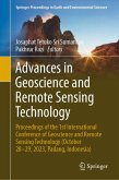
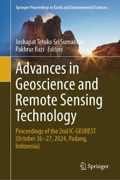
The book is a compilation of research presented at the 2nd International Conference of Geoscience and Remote Sensing Technology (IC-GEOREST), which took place between October 26 and 27, 2024, in Padang, Indonesia. Similar to the first conference held in 2023, the 2024 conference aimed to explore and showcase cutting-edge advancements, methodologies, and applications in the field of geoscience and remote sensing technology. IC-GEOREST contributes to fostering collaborations, sharing knowledge, and driving innovation across disciplines to support the Sustainable Development Goals and green…mehr

  • Geräte: PC
  • ohne Kopierschutz
  • eBook Hilfe
  • Größe: 362.21MB
Produktbeschreibung
The book is a compilation of research presented at the 2nd International Conference of Geoscience and Remote Sensing Technology (IC-GEOREST), which took place between October 26 and 27, 2024, in Padang, Indonesia. Similar to the first conference held in 2023, the 2024 conference aimed to explore and showcase cutting-edge advancements, methodologies, and applications in the field of geoscience and remote sensing technology. IC-GEOREST contributes to fostering collaborations, sharing knowledge, and driving innovation across disciplines to support the Sustainable Development Goals and green earth.

The volume highlights the significance of geoscience and remote sensing technology in addressing global challenges and problems. The topics include instruments and technologies, applications to disaster monitoring and prediction, climate change, natural resources exploration, deforestation, land use and land cover, and ocean observation, among others.


Dieser Download kann aus rechtlichen Gründen nur mit Rechnungsadresse in A, B, BG, CY, CZ, D, DK, EW, E, FIN, F, GR, HR, H, IRL, I, LT, L, LR, M, NL, PL, P, R, S, SLO, SK ausgeliefert werden.

Autorenporträt
Prof. Josaphat Tetuko Sri Sumantyo, Ph.D, is a professor in the Center for Environmental Remote Sensing, Chiba University, Japan. He has developed leading techniques in remote sensing to observe continent, ocean and atmosphere, using satellite data and remote sensing devices, especially SAR. Prof. Pakhrur Razi, Ph.D. is a professor in physics disaster from the Center of Disaster Monitoring and Earth Observation, Universitas Negeri Padang, Indonesia. His research interests include the prediction of potential disasters using geoscience and remote sensing technology.