48,95 €
48,95 €
inkl. MwSt.
Sofort per Download lieferbar
payback
24 °P sammeln
48,95 €
48,95 €
inkl. MwSt.
Sofort per Download lieferbar

Alle Infos zum eBook verschenken
payback
24 °P sammeln
Als Download kaufen
48,95 €
inkl. MwSt.
Sofort per Download lieferbar
payback
24 °P sammeln
Jetzt verschenken
48,95 €
inkl. MwSt.
Sofort per Download lieferbar

Alle Infos zum eBook verschenken
payback
24 °P sammeln
  • Format: PDF

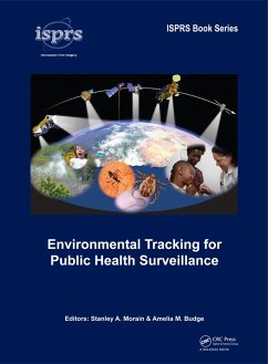
Satellite imagery and data are widely used in public health surveillance to provide early warning of disease outbreaks and for averting pandemics. Convergence of these technologies began in the 1970s and has gained wide acceptance in the 21st Century. This book is written jointly by experts in both the health and Earth-science technologies. Each chapter is accompanied by an extensive list of citations to provide background and validation of the current state-of-the-art for a variety of high-interest human diseases and associated health and well-being issues. The importance of day-to-day…mehr

Produktbeschreibung
Satellite imagery and data are widely used in public health surveillance to provide early warning of disease outbreaks and for averting pandemics. Convergence of these technologies began in the 1970s and has gained wide acceptance in the 21st Century. This book is written jointly by experts in both the health and Earth-science technologies. Each chapter is accompanied by an extensive list of citations to provide background and validation of the current state-of-the-art for a variety of high-interest human diseases and associated health and well-being issues. The importance of day-to-day weather patterns, the impacts of severe weather events and longer-term climate cycles form the basis for developing information systems that meet goals and expectations of national and international health monitoring bodies.

Dieser Download kann aus rechtlichen Gründen nur mit Rechnungsadresse in A, B, BG, CY, CZ, D, DK, EW, E, FIN, F, GR, HR, H, IRL, I, LT, L, LR, M, NL, PL, P, R, S, SLO, SK ausgeliefert werden.

Autorenporträt
The editors have spent almost 85 years developing satellite-based environmental applications, the most recent 20-years of which have focused on developing respiratory heath applications funded by the Applied Sciences Division of the National Aeronautics and Space Administration. They have been active professionally in the American Society for Photogrammetry and Remote Sensing (ASPRS) and the International Society for Photogrammetry and Remote Sensing (ISPRS). For most of their funded R&D efforts they have served as principal investigators and co-PIs on multidisciplinary teams.  In addition to peer-reviewed technical publications, they have served as author-editors for several books and sponsored research reports. Stanley Morain is currently Professor Emeritus of Geography and retired director of the Earth Data Analysis Center, University of New Mexico. Amelia Budge continues to be a co-PI on a NASA-sponsored multi-year project to develop a Pollen Regional Atmospheric Model (PREAM) for respiratory health. She recently completed her duties as Chairperson of the 2008-2012 ISPRS working group for Commission VIII (Remote Sensing Applications and Policy), Working Group 2 (Health).