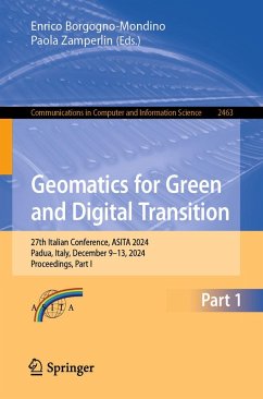
Geomatics for Green and Digital Transition (eBook, PDF)
27th Italian Conference, ASITA 2024, Padua, Italy, December 9-13, 2024, Proceedings, Part I
Redaktion: Borgogno-Mondino, Enrico; Zamperlin, Paola
120,95 €
120,95 €
inkl. MwSt.
Sofort per Download lieferbar

60 °P sammeln
120,95 €
Als Download kaufen

120,95 €
inkl. MwSt.
Sofort per Download lieferbar

60 °P sammeln
Jetzt verschenken
Alle Infos zum eBook verschenken
120,95 €
inkl. MwSt.
Sofort per Download lieferbar
Alle Infos zum eBook verschenken

60 °P sammeln
Geomatics for Green and Digital Transition (eBook, PDF)
27th Italian Conference, ASITA 2024, Padua, Italy, December 9-13, 2024, Proceedings, Part I
Redaktion: Borgogno-Mondino, Enrico; Zamperlin, Paola
- Format: PDF
- Merkliste
- Auf die Merkliste
- Bewerten Bewerten
- Teilen
- Produkt teilen
- Produkterinnerung
- Produkterinnerung

Bitte loggen Sie sich zunächst in Ihr Kundenkonto ein oder registrieren Sie sich bei
bücher.de, um das eBook-Abo tolino select nutzen zu können.
Hier können Sie sich einloggen
Hier können Sie sich einloggen
Sie sind bereits eingeloggt. Klicken Sie auf 2. tolino select Abo, um fortzufahren.

Bitte loggen Sie sich zunächst in Ihr Kundenkonto ein oder registrieren Sie sich bei bücher.de, um das eBook-Abo tolino select nutzen zu können.
The two-volume set CCIS 2463-2464 constitutes the proceedings of the 27th Italian Conference on Geomatics for Green and Digital Transition, ASITA 2024, held in Padua, Italy, during December 9-13, 2024.
The 54 full papers were carefully reviewed and selected from 139 submissions. They were organized in topical sections as follows:
Part I:
Natural Hazards and Emergencies
Urban Systems: Structures, Cities, and Infrastructure
Part II:
Cultural Heritage and Landscape Management
Agriculture and Forests
Environmental Applications of Geomatics
- Geräte: PC
- ohne Kopierschutz
- eBook Hilfe
- Größe: 169.04MB
Andere Kunden interessierten sich auch für
![Geomatics for Green and Digital Transition (eBook, PDF) Geomatics for Green and Digital Transition (eBook, PDF)]() Geomatics for Green and Digital Transition (eBook, PDF)68,95 €
Geomatics for Green and Digital Transition (eBook, PDF)68,95 €![Web and Wireless Geographical Information Systems (eBook, PDF) Web and Wireless Geographical Information Systems (eBook, PDF)]() Web and Wireless Geographical Information Systems (eBook, PDF)38,95 €
Web and Wireless Geographical Information Systems (eBook, PDF)38,95 €![Geomatics for Green and Digital Transition (eBook, PDF) Geomatics for Green and Digital Transition (eBook, PDF)]() Geomatics for Green and Digital Transition (eBook, PDF)60,95 €
Geomatics for Green and Digital Transition (eBook, PDF)60,95 €![Spatial Cognition XI (eBook, PDF) Spatial Cognition XI (eBook, PDF)]() Spatial Cognition XI (eBook, PDF)40,95 €
Spatial Cognition XI (eBook, PDF)40,95 €![Conceptual Modeling (eBook, PDF) Conceptual Modeling (eBook, PDF)]() Conceptual Modeling (eBook, PDF)59,95 €
Conceptual Modeling (eBook, PDF)59,95 €![Advances in Conceptual Modeling (eBook, PDF) Advances in Conceptual Modeling (eBook, PDF)]() Advances in Conceptual Modeling (eBook, PDF)52,95 €
Advances in Conceptual Modeling (eBook, PDF)52,95 €![Geomatics for Environmental Monitoring: From Data to Services (eBook, PDF) Geomatics for Environmental Monitoring: From Data to Services (eBook, PDF)]() Geomatics for Environmental Monitoring: From Data to Services (eBook, PDF)88,95 €
Geomatics for Environmental Monitoring: From Data to Services (eBook, PDF)88,95 €-
-
-
The two-volume set CCIS 2463-2464 constitutes the proceedings of the 27th Italian Conference on Geomatics for Green and Digital Transition, ASITA 2024, held in Padua, Italy, during December 9-13, 2024.
The 54 full papers were carefully reviewed and selected from 139 submissions. They were organized in topical sections as follows:
Part I:
Natural Hazards and Emergencies
Urban Systems: Structures, Cities, and Infrastructure
Part II:
Cultural Heritage and Landscape Management
Agriculture and Forests
Environmental Applications of Geomatics
Dieser Download kann aus rechtlichen Gründen nur mit Rechnungsadresse in A, B, BG, CY, CZ, D, DK, EW, E, FIN, F, GR, HR, H, IRL, I, LT, L, LR, M, NL, PL, P, R, S, SLO, SK ausgeliefert werden.
Produktdetails
- Produktdetails
- Verlag: Springer International Publishing
- Seitenzahl: 421
- Erscheinungstermin: 26. September 2025
- Englisch
- ISBN-13: 9783031911415
- Artikelnr.: 75531309
- Verlag: Springer International Publishing
- Seitenzahl: 421
- Erscheinungstermin: 26. September 2025
- Englisch
- ISBN-13: 9783031911415
- Artikelnr.: 75531309
- Herstellerkennzeichnung Die Herstellerinformationen sind derzeit nicht verfügbar.
Natural Hazards and Emergencies.- Surface Soil Moisture Estimate by Integration of Optical Remote Sensing and Low-Cost Field Sensor Network: The Case Study of Ceriana-Mainardo (Liguria, Italy).- Integrated Geomatic Surveys to Support Hydraulic Studies.- Mapping Burned Areas with Optical and Sentinel-1 Synthetic Aperture Radar Data.- InSAR EGMS for Wide-Area Assessment of Extreme Rainfall-related Modifications of Ground Deformation Patterns: the Case of Vaia Rainstorm.- GIS-Based Assessment of World War I UXO Occurrence Probability through Military Maps and Aerial Imagery on the Grappa Massif (NE Italy).- Unmanned Aerial Vehicles (UAV) in Supporting Firefighters Activities in Extreme Weather Calamities: A Real-case Application.- Linking the European Ground Motion Service with the Italian Landslide Inventory to Explore the Potential of Satellite Monitoring.- Influence of Data Preprocessing and Optimization in Multivariate Statistical Analysis of Landslide Susceptibility.- Mapping the Threat: Using a Geospatial Lens on Malakand Division, Pakistan, to Gain Early Insights into Antimicrobial Resistance (AMR).- A Preliminary Geospatial Analysis of Out-of-Hospital Cardiac Arrests in Lombardy.- On the Use of a Hydrogeomorphic Flood Modelling Framework for Building-Scale Assessment of NATCAT Impacts at Large Scale: the GEOSAFE Case Study in Italy.- Urban Systems: Structures, Cities, and Infrastructure.- Snap4City Digital Twin meeting European CityVerse Action.- Groupware Planning Support Tools. The SIMS Approach.- Ecosystem Services Assessment through GeoAI Applications for Driving Urban Planning Processes.- Benefits of Low-Cost GIS-Based Tools for Evaluating Ecosystem Services of Urban Green Spaces.- Dynamics between Population Distribution and Location of Services: the Case Study of Desio, Italy.- Urban Heat Islands in Palermo: Land Surface Temperature Analysis of a Mediterranean Coastal City.- Mapping out the Territorial Dynamics: The Geography of Recycling and Reuse of Second Raw Materials in Industrial Zones.- A Comparison of Algorithms for the Spatial Clustering of Technological Assets.- Accessibility Evaluation in Cortina d Ampezzo: Use of Advanced Geomatics Technologies for Inclusive Design.- Composite Index to Evaluate Urban Settlements Efficiency. An application to the Territorial Context of Baronissi Municipality.- Investigating the Safety of Green Areas in Naples through the Analysis of Environmental Risk and Crime Risk.- A Model Based on Environmental Quality Indicators to Support the Assessment of the Safety Perception of Urban Parks.- Knowledge for Sustainable Planning: UnivAQ s Contribution to the GeoSciencesIR Research Infrastructure.- Urban Regeneration Using the Sound: the Project Augmented Reality Soundscape (ARS).- A Novel Spatial Unit to Improve Representation in Crime Mapping: the Toronto, Canada example.- Satellite Data Analysis and Geographic Information System to Support Urban Planning: State of the Art.- Assessing the Quality of a Topographic Database using SLAM Technology: Proposal for an Operational Procedure.
Natural Hazards and Emergencies.- Surface Soil Moisture Estimate by Integration of Optical Remote Sensing and Low-Cost Field Sensor Network: The Case Study of Ceriana-Mainardo (Liguria, Italy).- Integrated Geomatic Surveys to Support Hydraulic Studies.- Mapping Burned Areas with Optical and Sentinel-1 Synthetic Aperture Radar Data.- InSAR EGMS for Wide-Area Assessment of Extreme Rainfall-related Modifications of Ground Deformation Patterns: the Case of Vaia Rainstorm.- GIS-Based Assessment of World War I UXO Occurrence Probability through Military Maps and Aerial Imagery on the Grappa Massif (NE Italy).- Unmanned Aerial Vehicles (UAV) in Supporting Firefighters Activities in Extreme Weather Calamities: A Real-case Application.- Linking the European Ground Motion Service with the Italian Landslide Inventory to Explore the Potential of Satellite Monitoring.- Influence of Data Preprocessing and Optimization in Multivariate Statistical Analysis of Landslide Susceptibility.- Mapping the Threat: Using a Geospatial Lens on Malakand Division, Pakistan, to Gain Early Insights into Antimicrobial Resistance (AMR).- A Preliminary Geospatial Analysis of Out-of-Hospital Cardiac Arrests in Lombardy.- On the Use of a Hydrogeomorphic Flood Modelling Framework for Building-Scale Assessment of NATCAT Impacts at Large Scale: the GEOSAFE Case Study in Italy.- Urban Systems: Structures, Cities, and Infrastructure.- Snap4City Digital Twin meeting European CityVerse Action.- Groupware Planning Support Tools. The SIMS Approach.- Ecosystem Services Assessment through GeoAI Applications for Driving Urban Planning Processes.- Benefits of Low-Cost GIS-Based Tools for Evaluating Ecosystem Services of Urban Green Spaces.- Dynamics between Population Distribution and Location of Services: the Case Study of Desio, Italy.- Urban Heat Islands in Palermo: Land Surface Temperature Analysis of a Mediterranean Coastal City.- Mapping out the Territorial Dynamics: The Geography of Recycling and Reuse of Second Raw Materials in Industrial Zones.- A Comparison of Algorithms for the Spatial Clustering of Technological Assets.- Accessibility Evaluation in Cortina d Ampezzo: Use of Advanced Geomatics Technologies for Inclusive Design.- Composite Index to Evaluate Urban Settlements Efficiency. An application to the Territorial Context of Baronissi Municipality.- Investigating the Safety of Green Areas in Naples through the Analysis of Environmental Risk and Crime Risk.- A Model Based on Environmental Quality Indicators to Support the Assessment of the Safety Perception of Urban Parks.- Knowledge for Sustainable Planning: UnivAQ s Contribution to the GeoSciencesIR Research Infrastructure.- Urban Regeneration Using the Sound: the Project Augmented Reality Soundscape (ARS).- A Novel Spatial Unit to Improve Representation in Crime Mapping: the Toronto, Canada example.- Satellite Data Analysis and Geographic Information System to Support Urban Planning: State of the Art.- Assessing the Quality of a Topographic Database using SLAM Technology: Proposal for an Operational Procedure.
