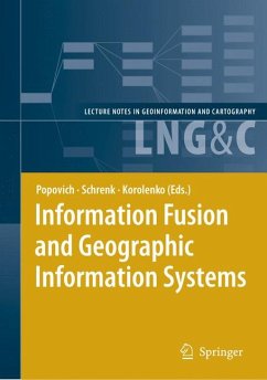
Information Fusion and Geographic Information Systems (eBook, PDF)
Proceedings of the Third International Workshop
Redaktion: Popovich, Vasily V.; Korolenko, Kyrill V.; Schrenk, Manfred
113,95 €
113,95 €
inkl. MwSt.
Sofort per Download lieferbar
57 °P sammeln
113,95 €
Als Download kaufen
113,95 €
inkl. MwSt.
Sofort per Download lieferbar
57 °P sammeln
Jetzt verschenken
Alle Infos zum eBook verschenken
113,95 €
inkl. MwSt.
Sofort per Download lieferbar
Alle Infos zum eBook verschenken
57 °P sammeln
Information Fusion and Geographic Information Systems (eBook, PDF)
Proceedings of the Third International Workshop
Redaktion: Popovich, Vasily V.; Korolenko, Kyrill V.; Schrenk, Manfred
- Format: PDF
- Merkliste
- Auf die Merkliste
- Bewerten Bewerten
- Teilen
- Produkt teilen
- Produkterinnerung
- Produkterinnerung
![](https://bilder.buecher.de/images/aktion/tolino/tolino-select-logo.png)
Bitte loggen Sie sich zunächst in Ihr Kundenkonto ein oder registrieren Sie sich bei
bücher.de, um das eBook-Abo tolino select nutzen zu können.
Hier können Sie sich einloggen
Sie sind bereits eingeloggt. Klicken Sie auf 2. tolino select Abo, um fortzufahren.
![](https://bilder.buecher.de/images/aktion/tolino/tolino-select-logo.png)
Bitte loggen Sie sich zunächst in Ihr Kundenkonto ein oder registrieren Sie sich bei bücher.de, um das eBook-Abo tolino select nutzen zu können.
These Proceedings of the Third International Workshop introduce research results in the areas of information integration, development of GIS and GIS-applications for a wide spectrum of information systems varying considerably in purpose and scale. The new class of GIS - intelligent GIS - is considered, including principles of their building and programming technologies. Special attention is drawn to the development of ontologies and their use in GIS and GIS-applications.
- Geräte: PC
- ohne Kopierschutz
- eBook Hilfe
- Größe: 12.15MB
Andere Kunden interessierten sich auch für
- Information Fusion and Geographic Information Systems (eBook, PDF)113,95 €
- Geographic Information and Cartography for Risk and Crisis Management (eBook, PDF)113,95 €
- Information Fusion and Intelligent Geographic Information Systems (IF&IGIS'17) (eBook, PDF)113,95 €
- Location Based Services and TeleCartography (eBook, PDF)161,95 €
- Headway in Spatial Data Handling (eBook, PDF)233,95 €
- Wolfgang KresseISO Standards for Geographic Information (eBook, PDF)113,95 €
- Frontiers of Geographic Information Technology (eBook, PDF)113,95 €
-
-
-
These Proceedings of the Third International Workshop introduce research results in the areas of information integration, development of GIS and GIS-applications for a wide spectrum of information systems varying considerably in purpose and scale. The new class of GIS - intelligent GIS - is considered, including principles of their building and programming technologies. Special attention is drawn to the development of ontologies and their use in GIS and GIS-applications.
Dieser Download kann aus rechtlichen Gründen nur mit Rechnungsadresse in A, B, BG, CY, CZ, D, DK, EW, E, FIN, F, GR, HR, H, IRL, I, LT, L, LR, M, NL, PL, P, R, S, SLO, SK ausgeliefert werden.
Produktdetails
- Produktdetails
- Verlag: Springer Berlin Heidelberg
- Seitenzahl: 335
- Erscheinungstermin: 29. Oktober 2007
- Englisch
- ISBN-13: 9783540376293
- Artikelnr.: 37371825
- Verlag: Springer Berlin Heidelberg
- Seitenzahl: 335
- Erscheinungstermin: 29. Oktober 2007
- Englisch
- ISBN-13: 9783540376293
- Artikelnr.: 37371825
- Herstellerkennzeichnung Die Herstellerinformationen sind derzeit nicht verfügbar.
Invited Papers.- New Challenges for Defining Information Fusion Requirements.- Situation Management: Basic Concepts and Approaches.- Maritime GIS: From Monitoring to Simulation Systems.- Data, Information and Knowledge Harmonization, Integration and Fusion in GIS.- Intelligent Images Analysis in GIS.- Context-Driven Information Fusion for Operational Decision Making in Humanitarian Logistics.- From Battle Management Language (BML) to Automatic Information Fusion.- Centrope MAP: Combining X-Border Information from Multiple Sources for Planning Purposes.- Information Assurance and Protection in GIS.- Software Environment for Simulation and Evaluation of a Security Operation Center.- Security Policy Verification Tool for Geographical Information Systems.- Architecture Types of the Bit Permutation Instruction for General Purpose Processors.- New Public Key Cryptosystems Based on Difficulty of Factorization and Discrete Logarithm Problems.- GIS as a Basis for Monitoring Systems.- Application of a Dynamic Recurrent Neural Network in Spatio-Temporal Forecasting.- System of Traffic Control on the Basis of Cartographic Databases and Geoinformation Technologies.- Information Fusion of Land Laser Scanning for Geographic Information Systems.- Using GIS to Analyze Acute Myocardial Infarction in Turkey.- Ontologies and Programming Technologies for GIS and GIS Applications.- Obtaining Semantic Descriptions Based on Conceptual Schemas Embedded into a Geographic Context.- Representing the Semantic Content of Topological Relations into Spatial Databases.- Some Remarks on Topological Abstraction in Multi Representation Databases.- Intelligent Simulation of Hydrophysical Fields by Immunocomputing.- Visual Modeling of Spatial Processes.- Universal Data Model for Intelligent GIS.- 3D Graphics Applied to Maritime Safety.- Operations Research and TSMO for GIS Applications.- Northern Shield US-Russia Maritime Energy Security Cooperation.- Space-Extensive Targets Radar Search in the Presence of Noise.- Empirical Bayes Trajectory Estimation Based on Bearings from Moving Observer.