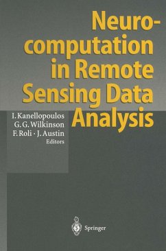
Neurocomputation in Remote Sensing Data Analysis (eBook, PDF)
Proceedings of Concerted Action COMPARES (Connectionist Methods for Pre-Processing and Analysis of Remote Sensing Data)
Redaktion: Kanellopoulos, Ioannis; Austin, James; Roli, Fabio; Wilkinson, Graeme G.
40,95 €
40,95 €
inkl. MwSt.
Sofort per Download lieferbar
20 °P sammeln
40,95 €
Als Download kaufen
40,95 €
inkl. MwSt.
Sofort per Download lieferbar
20 °P sammeln
Jetzt verschenken
Alle Infos zum eBook verschenken
40,95 €
inkl. MwSt.
Sofort per Download lieferbar
Alle Infos zum eBook verschenken
20 °P sammeln
Neurocomputation in Remote Sensing Data Analysis (eBook, PDF)
Proceedings of Concerted Action COMPARES (Connectionist Methods for Pre-Processing and Analysis of Remote Sensing Data)
Redaktion: Kanellopoulos, Ioannis; Austin, James; Roli, Fabio; Wilkinson, Graeme G.
- Format: PDF
- Merkliste
- Auf die Merkliste
- Bewerten Bewerten
- Teilen
- Produkt teilen
- Produkterinnerung
- Produkterinnerung
![](https://bilder.buecher.de/images/aktion/tolino/tolino-select-logo.png)
Bitte loggen Sie sich zunächst in Ihr Kundenkonto ein oder registrieren Sie sich bei
bücher.de, um das eBook-Abo tolino select nutzen zu können.
Hier können Sie sich einloggen
Sie sind bereits eingeloggt. Klicken Sie auf 2. tolino select Abo, um fortzufahren.
![](https://bilder.buecher.de/images/aktion/tolino/tolino-select-logo.png)
Bitte loggen Sie sich zunächst in Ihr Kundenkonto ein oder registrieren Sie sich bei bücher.de, um das eBook-Abo tolino select nutzen zu können.
A state-of-the-art view of recent developments in the use of artificial neural networks for analysing remotely sensed satellite data. Neural networks, as a new form of computational paradigm, appear well suited to many of the tasks involved in this image analysis. This book demonstrates a wide range of uses of neural networks for remote sensing applications and reports the views of a large number of European experts brought together as part of a concerted action supported by the European Commission.
- Geräte: PC
- ohne Kopierschutz
- eBook Hilfe
- Größe: 31.19MB
Andere Kunden interessierten sich auch für
- Handbook of Big Geospatial Data (eBook, PDF)177,95 €
- Patrick LaubeComputational Movement Analysis (eBook, PDF)40,95 €
- Remote Sensing of Forest Environments (eBook, PDF)169,95 €
- Václav TalhoferQuality of Spatial Data in Command and Control System (eBook, PDF)73,95 €
- Margarita N. FavorskayaHandbook on Advances in Remote Sensing and Geographic Information Systems (eBook, PDF)129,95 €
- Artificial Intelligence Techniques for Satellite Image Analysis (eBook, PDF)129,95 €
- Thomas GuyetChronicles: Formalization of a Temporal Model (eBook, PDF)36,95 €
-
-
-
A state-of-the-art view of recent developments in the use of artificial neural networks for analysing remotely sensed satellite data. Neural networks, as a new form of computational paradigm, appear well suited to many of the tasks involved in this image analysis. This book demonstrates a wide range of uses of neural networks for remote sensing applications and reports the views of a large number of European experts brought together as part of a concerted action supported by the European Commission.
Dieser Download kann aus rechtlichen Gründen nur mit Rechnungsadresse in A, B, BG, CY, CZ, D, DK, EW, E, FIN, F, GR, HR, H, IRL, I, LT, L, LR, M, NL, PL, P, R, S, SLO, SK ausgeliefert werden.
Produktdetails
- Produktdetails
- Verlag: Springer Berlin Heidelberg
- Seitenzahl: 284
- Erscheinungstermin: 6. Dezember 2012
- Englisch
- ISBN-13: 9783642590412
- Artikelnr.: 53108216
- Verlag: Springer Berlin Heidelberg
- Seitenzahl: 284
- Erscheinungstermin: 6. Dezember 2012
- Englisch
- ISBN-13: 9783642590412
- Artikelnr.: 53108216
- Herstellerkennzeichnung Die Herstellerinformationen sind derzeit nicht verfügbar.
Open Questions in Neurocomputing for Earth Observation.- A Comparison of the Characterisation of Agricultural Land Using Singular Value Decomposition and Neural Networks.- Land Cover Mapping from Remotely Sensed Data with a Neural Network: Accommodating Fuzziness.- Geological Mapping Using Multi-Sensor Data: A Comparison of Methods.- Application of Neural Networks and Order Statistics Filters to Speckle Noise Reduction in Remote Sensing Imaging.- Neural Nets and Multichannel Image Processing Applications.- Neural Networks for Classification of Ice Type Concentration from ERS-1 SAR Images. Classical Methods versus Neural Networks.- A Neural Network Approach to Spectral Mixture Analysis.- Comparison Between Systems of Image Interpretation.- Feature Extraction for Neural Network Classifiers.- Spectral Pattern Recognition by a Two-Layer Perceptron: Effects of Training Set Size.- Comparison and Combination of Statistical and Neural Network Algorithms for Remote-Sensing Image Classification.- Integrating the Alisa Classifier with Knowledge-Based Methods for Cadastral-Map Interpretation.- A Hybrid Method for Preprocessing and Classification of SPOT Images.- Testing some Connectionist Approaches for Thematic Mapping of Rural Areas.- Using Artificial Recurrent Neural Nets to Identify Spectral and Spatial Patterns for Satellite Imagery Classification of Urban Areas.- Dynamic Segmentation of Satellite Images Using Pulsed Coupled Neural Networks.- Non-Linear Diffusion as a Neuron-Like Paradigm for Low-Level Vision.- Application of the Constructive Mikado-Algorithm on Remotely Sensed Data.- A Simple Neural Network Contextual Classifier.- Optimising Neural Networks for Land Use Classification.- High Speed Image Segmentation Using a Binary Neural Network.- Efficient Processing and Analysis of Images Using Neural Networks.- Selection of the Number of Clusters in Remote Sensing Images by Means of Neural Networks.- A Comparative Study of Topological Feature Maps Versus Conventional Clustering for (Multi-Spectral) Scene Identification in METEOSAT Imagery.- Seif Organised Maps: the Combined Utilisation of Feature and Novelty Detectors.- Generalisation of Neural Network Based Segmentation Results for Classification Purposes.- Remote Sensing Applications Which may be Addressed by Neural Networks Using Parallel Processing Technology.- General Discussion.