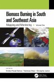
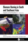
Volume 1 showcases the practical utility of remote sensing data in various LCLUC studies. The book features contributions from the NASA-funded South/Southeast Asia Research Initiative and collaborators from multiple countries in South and Southeast Asia.
Key Features:
- Explores the latest methodologies, from deep learning to novel data integrations, for mapping LCLUC.
- Demonstrates case studies to monitor and map land cover changes using very-high, medium, and coarse-resolution satellite data.
- Highlights the role of remote sensing in integrating biophysical and socioeconomic data.
- Provides case studies on urban expansion, deforestation, and agricultural intensification.
- Demonstrates advanced remote sensing methods for tracking land use changes.
- Offers insights into sustainable land management using remote sensing and geospatial technologies.
This book serves as a cornerstone for advancing research and collaboration in the field of remote sensing and land use studies, particularly in South and Southeast Asia. It will be an invaluable resource for mapping and monitoring professionals, including remote sensing experts, geographers, environmental scientists, ecologists, and all others involved in land use/cover change research.
Dieser Download kann aus rechtlichen Gründen nur mit Rechnungsadresse in A, B, BG, CY, CZ, D, DK, EW, E, FIN, F, GR, HR, H, IRL, I, LT, L, LR, M, NL, PL, P, R, S, SLO, SK ausgeliefert werden.


