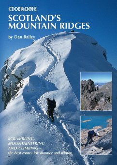
Guidebook to exploring Scotland's finest mountain ridges through climbing, scrambling and winter mountaineering. With 47 routes across Lochaber, Cairngorms, the North and West Highlands, Skye, Rum, Arran and the Southern Highlands, this guide contains something for all levels of experience and ability, from mountain walkers to scramblers, climbers and mountaineers.
The routes range from 326 miles (442km) in length and are graded from ModerateVery Severe (climbs), 13 (scrambles) and IIII/3 (winter mountaineering).
The routes range from 326 miles (442km) in length and are graded from ModerateVery Severe (climbs), 13 (scrambles) and IIII/3 (winter mountaineering).
- 1:50,000 OS mapping included for the approach to and descent off each ridge
- Clear route descriptions and topo diagrams of the ridge scrambles and climbs
- Includes classic routes on Ben Nevis, the Aonachs, Glen Coe, Coire an t-Sneachda, Torridon, the Cobbler, Ben Lui, Mitre Ridge, An Teallach Traverse and Cuillin Main Ridge Traverse
- Routes accessible from key bases including Fort William, Kyle of Lochalsh, Aviemore, Gairloch, Lochinver, Arrochar and Cranlarich
- Advice on difficulty, access, accommodation and wild camping, and seasonal notes on choosing the best conditions to tackle each route
Dieser Download kann aus rechtlichen Gründen nur mit Rechnungsadresse in A, D ausgeliefert werden.

