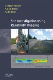
Site Investigation using Resistivity Imaging aims to summarize pertinent details of RI in site investigation for geotechnical and geo-environmental applications. It aims to bridge the gap that currently exists between the geotechnical/geo-environmental and geophysical engineering community. The geotechnical and geo-environmental engineers will be able to use annd understand geophysical data and utilize the information for their design.
Features:
- First comprehensive handbook aimed at engineers that summarises pertinent details of Resitivity Imaging (RI) in site investigation for geotechnical and geo-environmental applications.
- for geotechnical and geoenvironmental engineers, making it possible to interpret geophysical data and utilize the information for their design.
- explanining the advantages of RI over conventional site investigations: continuous image, large coverage, low cost, quick and easy data processing.
It will be a comprehensive handbook for the application of RI in geotechnical and geo-environmental site investigations.
Dieser Download kann aus rechtlichen Gründen nur mit Rechnungsadresse in A, B, BG, CY, CZ, D, DK, EW, E, FIN, F, GR, HR, H, IRL, I, LT, L, LR, M, NL, PL, P, R, S, SLO, SK ausgeliefert werden.


