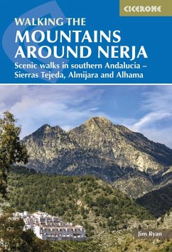
A guidebook to 32 day walks in and around the coastal town of Nerja, Spain. Exploring the mountains, gorges and white mountain villages of the Sierras Tejeda and Almijara and Alhama Natural Park in southern Andalucia, there are routes for walkers of all levels of fitness and experience.
The walks are graded by difficulty and range from 3-22km (2-14 miles) in length, covering 110-1420m of ascent and taking between 1hr 30min and 7hr 30min to complete.
The walks are graded by difficulty and range from 3-22km (2-14 miles) in length, covering 110-1420m of ascent and taking between 1hr 30min and 7hr 30min to complete.
- Clear description of the route alongside 1:50,000 or 1:25,000 maps
- Highlights include ascents of La Maroma, Cisne and Navachica
- Packed with information on local history, geology and wildlife
- Each walk features detailed instructions on getting to the start, plus where to find refreshments and water sources
- Some routes visit sections of the 700km (430 mile) Gran Senda de Malaga (Great Path of Malaga)
- Easy access from Nerja, Velez-Malaga and Cómpeta
- GPX files available to download
Dieser Download kann aus rechtlichen Gründen nur mit Rechnungsadresse in A, D ausgeliefert werden.

