4,49 €
4,49 €
inkl. MwSt.
Sofort per Download lieferbar
payback
0 °P sammeln
4,49 €
4,49 €
inkl. MwSt.
Sofort per Download lieferbar

Alle Infos zum eBook verschenken
payback
0 °P sammeln
Als Download kaufen
4,49 €
inkl. MwSt.
Sofort per Download lieferbar
payback
0 °P sammeln
Jetzt verschenken
4,49 €
inkl. MwSt.
Sofort per Download lieferbar

Alle Infos zum eBook verschenken
payback
0 °P sammeln
  • Format: ePub

This comprehensive guide to thematic mapping provides essential knowledge for students, educators, and professionals in geographic information systems (GIS) and cartography. Originally developed for academic instruction at the National Survey Authority, Ministry of Defence, Oman, this book covers fundamental principles including statistical data analysis, chart creation, data symbolization, and various thematic mapping techniques. Readers will find practical guidance on choropleth maps, dasymetric mapping, isolines, prism maps, and software applications with ArcGIS examples. The book bridges…mehr

  • Geräte: eReader
  • mit Kopierschutz
  • eBook Hilfe
  • Größe: 3.71MB
  • FamilySharing(5)
Produktbeschreibung
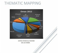
This comprehensive guide to thematic mapping provides essential knowledge for students, educators, and professionals in geographic information systems (GIS) and cartography. Originally developed for academic instruction at the National Survey Authority, Ministry of Defence, Oman, this book covers fundamental principles including statistical data analysis, chart creation, data symbolization, and various thematic mapping techniques. Readers will find practical guidance on choropleth maps, dasymetric mapping, isolines, prism maps, and software applications with ArcGIS examples. The book bridges theoretical concepts with real-world applications, offering clear explanations of quantitative and qualitative mapping methods, cartographic correlation, and professional map production standards. An invaluable resource for anyone seeking to master the art and science of visualizing geographic information effectively.


Dieser Download kann aus rechtlichen Gründen nur mit Rechnungsadresse in A, B, CY, CZ, D, DK, EW, E, FIN, F, GR, H, IRL, I, LT, L, LR, M, NL, PL, P, R, S, SLO, SK ausgeliefert werden.

Autorenporträt
Sayed Athar Ali Hashmi is a dedicated geospatial professional and educator with extensive experience in Geographic Information Systems (GIS) and cartography. He served as a Geo-informatics Lecturer at the National Survey Authority (NSA) of the Ministry of Defence (MOD) in Oman, where he was responsible for developing curriculum and training the next generation of mapping specialists. It was during this tenure that he authored Thematic Mapping as a comprehensive guide for his students. His expertise lies in translating complex spatial data concepts into practical, understandable knowledge, empowering professionals to create clear and impactful geographic visualizations.