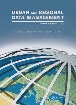
Urban and Regional Data Management (eBook, ePUB)
UDMS Annual 2013
Redaktion: Ellul, Claire; Laurini, Robert; Rumor, Massimo; Zlatanova, Sisi
51,95 €
51,95 €
inkl. MwSt.
Sofort per Download lieferbar
26 °P sammeln
51,95 €
Als Download kaufen
51,95 €
inkl. MwSt.
Sofort per Download lieferbar
26 °P sammeln
Jetzt verschenken
Alle Infos zum eBook verschenken
51,95 €
inkl. MwSt.
Sofort per Download lieferbar
Alle Infos zum eBook verschenken
26 °P sammeln
Urban and Regional Data Management (eBook, ePUB)
UDMS Annual 2013
Redaktion: Ellul, Claire; Laurini, Robert; Rumor, Massimo; Zlatanova, Sisi
- Format: ePub
- Merkliste
- Auf die Merkliste
- Bewerten Bewerten
- Teilen
- Produkt teilen
- Produkterinnerung
- Produkterinnerung

Bitte loggen Sie sich zunächst in Ihr Kundenkonto ein oder registrieren Sie sich bei
bücher.de, um das eBook-Abo tolino select nutzen zu können.
Hier können Sie sich einloggen
Sie sind bereits eingeloggt. Klicken Sie auf 2. tolino select Abo, um fortzufahren.

Bitte loggen Sie sich zunächst in Ihr Kundenkonto ein oder registrieren Sie sich bei bücher.de, um das eBook-Abo tolino select nutzen zu können.
The Urban Data Management Society has organised international symposia at various locations throughout Europe since 1971, and UDMS 2013 marks its second visit to London. From its outset, UDMS has highlighted changes and trends in urban data and urban data management. However, the rate of emergence of new data and new technologies has never been as
- Geräte: eReader
- mit Kopierschutz
- eBook Hilfe
Andere Kunden interessierten sich auch für
Environmental Tracking for Public Health Surveillance (eBook, ePUB)43,95 €
GlobalSoilMap - Digital Soil Mapping from Country to Globe (eBook, ePUB)175,95 €
Biao LiuSpatio-temporal Analysis and Optimization of Land Use/Cover Change (eBook, ePUB)64,95 €
Urban and Regional Data Management (eBook, PDF)51,95 €
Urban and Regional Data Management (eBook, ePUB)224,95 €
Urban and Regional Data Management (eBook, ePUB)243,95 €
Urban and Regional Data Management (eBook, ePUB)51,95 €-
-
-
The Urban Data Management Society has organised international symposia at various locations throughout Europe since 1971, and UDMS 2013 marks its second visit to London. From its outset, UDMS has highlighted changes and trends in urban data and urban data management. However, the rate of emergence of new data and new technologies has never been as
Dieser Download kann aus rechtlichen Gründen nur mit Rechnungsadresse in A, B, BG, CY, CZ, D, DK, EW, E, FIN, F, GR, HR, H, IRL, I, LT, L, LR, M, NL, PL, P, R, S, SLO, SK ausgeliefert werden.
Produktdetails
- Produktdetails
- Verlag: Taylor & Francis eBooks
- Seitenzahl: 260
- Erscheinungstermin: 23. Mai 2013
- Englisch
- ISBN-13: 9781134638772
- Artikelnr.: 72584412
- Verlag: Taylor & Francis eBooks
- Seitenzahl: 260
- Erscheinungstermin: 23. Mai 2013
- Englisch
- ISBN-13: 9781134638772
- Artikelnr.: 72584412
- Herstellerkennzeichnung Die Herstellerinformationen sind derzeit nicht verfügbar.
Claire Ellul, University College London, UK. Sisi Zlatanova, Delft University of Technology, Delft, The Netherlands. Massimo Rumor, University of Padova, Padova, Italy. Robert Laurini, INSA de Lyon, France.
Introduction; Part 1: Urban development: Cost function for route
accessibility with a focus on disabled people confined to a wheelchair: The
TOURRENIA Project; Criteria of dwelling quality; Offer prices, data mining
and spatial econometrics: A complementary approach to study real estate
market dynamics; Eras of electric vehicles: Electric mobility on the
verge-Focus Attention Scale; Part 2: Statistics and geo-visualisation: A
test to check the efficiency of visual representation of urban data;
Chorems: A new tool for territorial intelligence; Spatial point pattern
analysis of lung cancer in an urban area: Izmir case; A qualitative data
cube-building sites annoyance analysis use case; Part 3: Smart cities and
big data: EdgeCrack: A parallel Divide-and-Conquer algorithm for building a
topological data structure; Making sense of smart city sensors; City as a
social network-Brazilian examples; Part 4: Remote sensing: Monitoring
peri-urban land use change with multi-temporal Landsat imagery Analyzing
urban sprawl applying spatial autocorrelation techniques to multi-temporal
satellite data; Building extraction from high resolution multi-spectral
satellite images; Part 5: 3D Modelling and applications: A schema-aware
encoder for Putrajaya 3D; Detecting shadow for direct radiation using
CityGML models for photovoltaic potentiality analysis; Geometric validation
of 3D city models based on standardized quality criteria; 3D printing for
urban planning: A physical enhancement of spatial perspective Part 6:
Ontologies: LARKS: An ontology-based algorithm for geographic web service
discovery; Research on geo-ontologies at earthquake domain for disaster
management on urban areas.